KAMHA GOLD PROJECT
Project Summary
Maximizing Value Through Robust, Low-Cost Gold Production
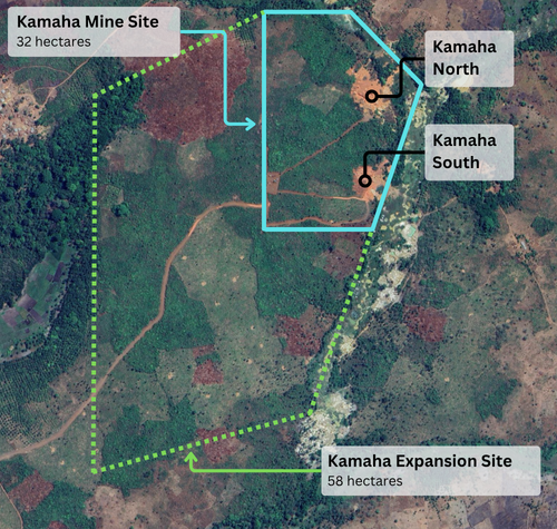
The wholly owned Kamaha Gold Project is located approximately 100 km north of Makeni, Sierra Leone, and encompasses a 32-hectare mining concession with valid mineral rights permitting extraction activities through 2034. The Project lies within the Archean Loko Group greenstone belt and hosts orogenic lode-gold mineralization characterized by vertically oriented quartz–carbonate vein systems.
The Kamaha Gold Project is a low-cost, high-grade gold mining asset, with strong operational leverage and the potential for enhanced profitability through incremental throughput and improved recovery. The project is currently undergoing an expansion program, including the construction and commissioning of a new processing plant designed to increase processing capacity and optimize gold recovery. Strata Resource Group holds sole controlling interest in the Kamaha Gold Project through a joint venture with its subsidiary, Bright Continent Minerals Limited (BCM Ltd.). This strategic partnership combines Strata’s capital and management expertise with BCM’s operational and exploration experience, providing a robust framework for both near-term production growth and longer-term resource expansion, positioning the Kamaha Gold Project as a significant orogenic gold development asset in northwestern Sierra Leone.
Gold
Resource
and
Low Cost
Established Deposit, Significant Upside
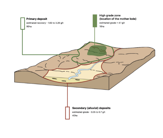
The Kamaha Gold Project is situated within the Archean Loko Group greenstone belt, a supracrustal sequence of metamorphosed volcanic and sedimentary rocks that host numerous documented occurrences of gold mineralization in northwestern Sierra Leone. Mineralization at Kamaha is consistent with structurally controlled, orogenic lode-gold systems typical of Archean greenstone belts. The project encompasses multiple vertically oriented quartz–carbonate vein systems containing high-grade gold mineralization. The existing claim area hosts a high-grade deposit, interpreted to represent the primary lode. Furthermore, geological surveys have identified a 90-hectare area adjacent to the current site with significant gold potential, indicating that systematic exploration could materially expand the existing resource base.
Where Proven Resources Meet Operational Excellence
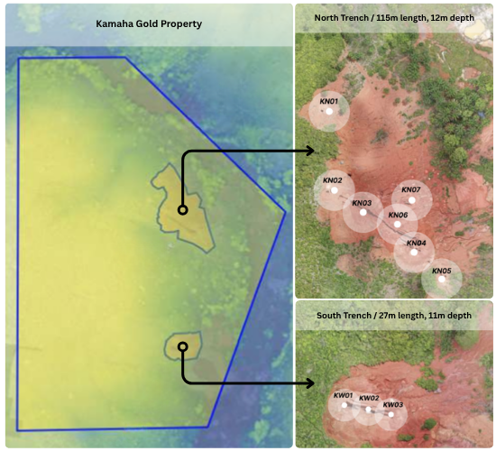
Kamaha North forms the foundation of the Kamaha Gold Project and comprises three primary, vertically oriented quartz–carbonate vein systems. Current surface mining operations are focused on extracting ore from these initial veins. To date, mineralization has been confirmed to a depth of 12 m; however, recent geophysical surveys indicate that the target ore body extends to approximately 30 m. Kamaha North is currently undergoing an expansion program, including the construction and commissioning of a new processing plant designed to increase throughput and optimize gold recovery.
Kamaha South serves as a secondary mining area, supporting Kamaha North by providing additional high-grade ore from a single, vertically oriented quartz–carbonate vein system. Current surface mining operations are focused on extracting ore from this primary vein. To date, mineralization has been confirmed to a depth of 11 m; however, recent geophysical surveys indicate that the target ore body extends to approximately 30 m.
Established Deposit, Significant Upside
The Kamaha Project exhibits significant exploration and resource expansion potential, both within the boundaries of the existing mining claim and in a 90-hectare contiguous adjacent area. Strata has assembled a multidisciplinary team of experts, including geologists, engineers, and legal specialists, to advance the project in accordance with best practices and regulatory standards. Click on each dropdown below to see how Strata’s current activities integrate modern exploration and processing technologies to optimize resource delineation and mineral recovery.
Drone Mapping
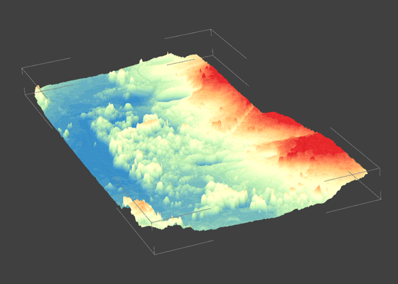
Unmanned aerial vehicle (UAV) surveys are utilized to produce high-resolution digital elevation models (DEMs) and orthomosaic imagery. These datasets facilitate the rapid identification of potential surface mineralization, support structural and lithological mapping, and provide a precise topographic framework for planning and development.
Seismic Surveying
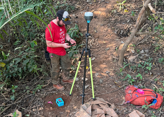
Passive seismic stratigraphy is applied to delineate the subsurface architecture and lithological characteristics of the ore bodies at the Kamaha Project. This geophysical technique provides detailed information on the depth, continuity, and structural controls of mineralized zones, supporting both resource modeling and the planning of surface and near-surface mining operations.
Pilot-Scale Testing
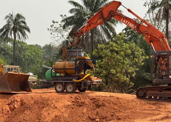
Pilot-scale testing is conducted at prospective targets across the Kamaha site to validate the results of prior geological surveys and to guide the prioritization of subsequent mining activities.